Roaring Water Bay |
|||||||||||
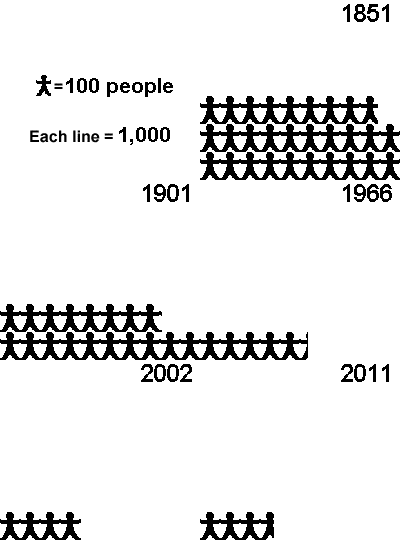
| Area | Totals | 4,194 | 2,890 | 2,076 | 1,810 | 1,635 | 536 | 363 | 401 | 358 | 397 |
| Sq. Km | Island / Year | 1841 | 1851 | 1881 | 1901 | 1911 | 1966 | 1996 | 2002 | 2006 | 2011 |
| 6.50 | Cape Clear | 1,052 | 819 | 594 | 601 | 565 | 217 | 145 | 129 | 125 | 124 |
| 5.25 | Sherkin | 1,131 | 696 | 449 | 350 | 296 | 92 | 98 | 129 | 106 | 114 |
| 3.85 | Ringarogy | 597 | 393 | 239 | 166 | 151 | 81 | 76 | 88 | 88 | 94 |
| 1.56 | Hare Island | 358 | 288 | 302 | 317 | 294 | 78 | 16 | 27 | 24 | 28 |
| 1.48 | Long Island | 336 | 305 | 210 | 199 | 175 | 47 | 9 | 12 | 5 | 10 |
| 1.46 | Inishbeg | 335 | 88 | 57 | 17 | 14 | 21 | 19 | 13 | 8 | 25 |
| 0.65 | Horse Island | 137 | 116 | 63 | 42 | 27 | 0 | 0 | 3 | 2 | 2 |
| 0.54 | Castle Island | 92 | 68 | 45 | 33 | 31 | 0 | 0 | 0 | 0 | 0 |
| 0.25 | Middle Calf | 39 | 29 | 32 | 18 | 18 | 0 | 0 | 0 | 0 | 0 |
| 0.24 | West Calf | 21 | 19 | 12 | 27 | 13 | 0 | 0 | 0 | 0 | 0 |
| 0.34 | East Calf | 19 | 8 | 23 | 7 | 9 | 0 | 0 | 0 | 0 | 0 |
| 0.20 | East Skeam | 29 | 27 | 24 | 22 | 27 | 0 | 0 | 0 | 0 | 0 |
| 0.13 | West Skeam | 22 | 14 | 21 | 11 | 15 | 0 | 0 | 0 | 0 | 0 |
| 0.44 | Spanish Island | 26 | 20 | 5 | 0 | 0 | 0 | 0 | 0 | 0 | 0 |
