


The long black currachs strained at their buoys in Inishbofin harbour, their retroussé noses snubbing the lines as a stiff west wind blew in from the Atlantic. A saucy cockerel screeched defiantly from his gatepost lookout, and purple orchids trembled in the breeze along the verges of the lane.

Grey or fine, windy or still, Connemara exerts magic on its visitors, especially out in these humpy granite islands of the west. We were lucky to be walking Inishbofin with Gerry McCloskey, a man who has forgotten more about the islands than I've ever imagined learning.
The bare soil of Connemara's island fields has always needed to be painstakingly manured, cultivated and carefully preserved from blowing away. We passed a neat and tiny vegetable garden, the heaped ridges growing carrots, onions, lettuces, beetroot and spuds, all buttressed from the salt sea wind by sturdy stone walls.
Out along the grassy track to the townland of Westquarter, the fields tended by former generations lay thick on either hand, corduroy ridges combed in parallel lines down slopes too steep and awkward for any horse plough.
Inishbofin is an island that holds its history close to the surface, to be read by anyone with a pair of eyes and a little curiosity. This rollercoaster of a track, leading out to the islanders' turf banks at the west end of Inishbofin, was built by hungry men and women as a Famine road when all their sweat and labour at the potato beds turned futile overnight. There was fish, of course, but the sea was hungry too, and it never lost its propensity to swallow men and currachs.
The cliffs of Westquarter hold poignant memorials -- a striking skeletal cross to Edward Moll and Richard Mathes, two Kansas students drowned while swimming, and above the beautiful creamy sands of Trá Gheal a memorial to three boys of the Lacey family, brothers Michael and Martin and their cousin Peter. All three were lost in 1949 when their currach tipped over on Easter Sunday morning as they rowed from their native Inishark to attend Mass.
Inishark had no priest. The island lacked a doctor, too, and a decent harbour. When a young man died of appendicitis because help could not be fetched in time, it spelled the end for human life on Inishark.
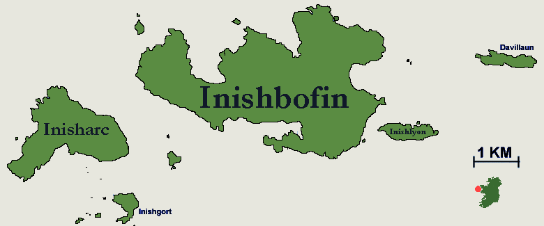
Looking across the quiet sands and the restless waters of Ship Sound to the roofless ruins of Inishark's village, imagination saw the final exodus by boat of the remaining couple of dozen islanders in 1960. They went to houses and land in Claddaghduff; their homeland entered a long isolation, still unbroken.
We turned down along crags of red shaly rock, moving across slopes where brisk little birds went skimming away, flashing their snowy rumps. They were wheatears, a politer bird-fancier's version of the earthy old name that countrymen knew them by -- 'white-arse'.
The massive stone blocks of Dún Mór promontory fort clung to a green, upslanted tongue of cliff. Beyond, Gerry showed us the scoop of ground where IRA men on the run would hide from soldiers searching the island during the War of Independence. Here lies a rough and stony region, exactly resembling a beach of shingle pebbles. That's just what it was, confirmed Gerry -- a raised beach, left high and dry after the Ice Age glaciers melted. All that weight of ice was lifted, and the land rose up like a sponge that had been squashed under a giant foot.
The Kansas students' memorial cross looks north towards the islets of The Stags. This is the westernmost and remotest quarter of Inishbofin, seething with the wildly tossing heads of bog cotton.
We walked on, circling round the cliffs. Two enormous blowholes opened at our feet, each big enough to sink a ship in, connected by a passageway through the canted rock strata that opened to the sea. In a northerly gale the holes spew spray with a boom to frighten the devil.
But today they lay quiet, in harmony with the mood of this soft grey afternoon on the western threshold of Ireland.
Christopher SomervilleIt had been another of those dreamy island days when time runs as thick and slow as honey. Inishbofin lay under the spell of the evening weather -- heavy cloud cover and a warm, gentle breeze.

We'd spent the morning wandering through the west end of the island, the afternoon idling around the harbour watching the ferries and fishing boats come and go.
There might be music later in the Doonmore Hotel. There certainly would be fish, chips and a few nice pints. But what about now? How to spend the early evening, now that the last ferry had departed for the world beyond the harbour mouth?
Island roads are social creatures. If you step out just past cup-of-tea-o'clock, you're bound to be met and gret. A very senior citizen, wearing a traditional islandman's tam o' shanter in chequered tweed, nodded to us from his front door where he was leaning slantwise, one jamb to the other.
"Enjoying our little lovely island?" "We certainly are!" "And you're very welcome. If you go along that way," -- he indicated the eastern-heading road -- "you'll meet yourself coming back in a pleasant hour or two."
That was such a nice way of putting it that we set out forthwith.
The Galway islands wear their histories in full view. Down by the old pier tottered the ruin of a herring-curing station, one of the hundreds of projects set up in Connemara by the Congested Districts Board in the hard times around the turn of the 20th century.
Out beyond it, Cromwell's Barracks clung to its rocky perch at the eastern tip of Inishbofin Harbour. Cromwell's men constructed the star-shaped fort there in 1656-7 on the site of a previous stronghold built by one Don Bosco, a Spanish buccaneer and friend of the O'Malley's of Inishbofin.
In those wild days, a mighty chain would be stretched nightly across the mouth of the inlet between Don Bosco's fort and Granuaille's block-like castle opposite, a disincentive to would-be strangers.
The wheel of history has turned, and nowadays the stranger feels like a friend here.
Edged with pyramidal orchids and pink windmills of ragged robin, the road curved and led us inland. Up behind the spiky whaleback of Knock hill, Church Lough lay low and reed-fringed under a spatter of yellow water lilies.
From the road summit we looked out across Inishlyon and the broad sound of Ballynakill to the westernmost shores of Connemara and the distant hummocks of the Twelve Bens, their peaks cut hard and definite against the low motionless clouds.
The drift of the shadows brushed their flanks with purple; every sun shaft dressed them in pale green.
Mweelrea was a solid lump in the east, and 20 miles away bare-shouldered Croagh Patrick stood with its pointed head in the clouds.
You need something special to pull you away from a view like that, and it was the corncrakes that supplied it.
Inishbofin is one of the very few places in Ireland to have retained a population of these secretive ground-nesting birds.
Corncrakes need long grass to nest and bring up their youngsters in concealment, and modern intensive farming -- with its insistence on cutting grass short, early and often -- has pretty well done for them.
But here on the island, patches of grass are deliberately left long to encourage the corncrakes. "Crex! Cre-e-e-x!" rang out from the overgrown graveyard of St Colman's monastery just down the road.
If corncrakes went in for 'The X Factor' they'd have been sneered out of the room long since. But that grating call is a conservationist's aria. Down in the beautiful little stone church and out among the ancient cross-slabs and bullauns of the graveyard we rejoiced over its harsh, triumphant rasp.
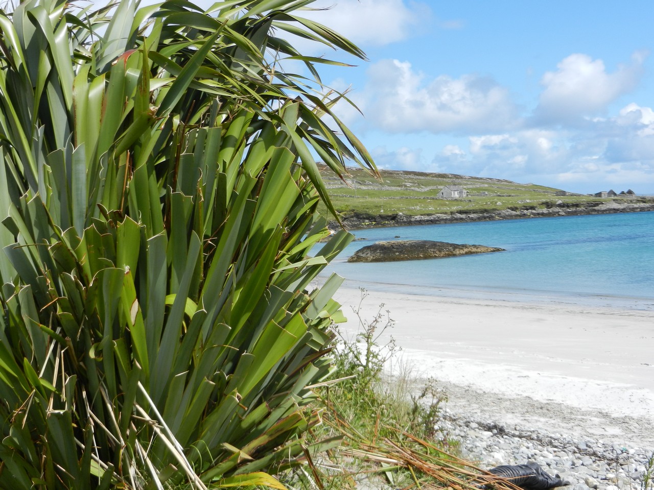
Buttercups, clovers, yellow rattle, marsh orchid; a rich carpet of wild flowers to beautify our evening walk. We turned north along East End Bay, past the old fishermen's cottages and on up the perfect fingernail of creamy sand, shoes in hand.
Time enough to meet ourselves coming back.
Just now, scuffing the heavy sand like silk between our toes, we were content to see absolutely no one else.
MAP: OS of Ireland 1:50,000 Discovery 37 GPS: satmap.com
TRAVEL:
Bus (citylink.ie): Galway-Cleggan.
Road: Cleggan is signed from N59 between Letterfrack and Clifden.
Ferries: Island Discovery (095 45819/45894; King Ferries (095 44649) from Cleggan to Inishbofin.
WALKING IN IRELAND: For walking tour operators, local walks and walking festivals throughout Ireland, see Discover Ireland - Walking
WALK DIRECTIONS: Bear left from pier along road past Doonmore Hotel; where tarmac ends, follow famine road and waymarked paths clockwise around cliffs. At sheep-dipping pond (beyond memorial cross to Kansas students) waymarks run out; aim for skyline near coast to continue, following coast back to hotel and pier.
LENGTH: Five miles -- allow three hours.
GRADE: Moderate.
CONDITIONS: Grass paths; one or two slopes; can be slippery after rain. Buggy-friendly along roads. Cliff edges are unguarded and sheer -- please take great care, especially with children and dogs!
DON'T MISS: Views over Trá Gheal to Inishark; Kansas students' memorial cross; the blow holes.
REFRESHMENTS/ACCOMMODATION: Doonmore Hotel (095 45814/04; doonmore hotel.com); Day's Hotel (095 45809; dayshotel.ie); Dolphin Hotel & Restaurant (095 45991; dolphinhotel.ie); Galley B&B and Restaurant (095 45894); Lapwing House (095 45996).
GUIDE BOOKS/LEAFLETS: Map-guide widely available on Inishbofin.
OPERATOR: Connemara Safari Walking Holidays (Gerry McCloskey). Tel: 095 21071 or Freephone 1850 777 200; Website
INFORMATION: See Inishbofin.com
